 LIDAR (Light Detection and Ranging) is a remote sensing / surveying technology that uses pulsed laser light to measure the distance from an airborne sensor to features on the surface of the earth, delivering critical data about man-made objects and natural terrain features.
Mapping professionals and scientists leverage LIDAR data to produce items such as 3D visualizations, mapping products and services, digital elevation models for use in geographic information systems, and more. These products and services are used to assist in mapping, engineering, 3D modeling, disaster management, volumetric studies, utilities corridor monitoring, emergency response operations, and in many other applications.
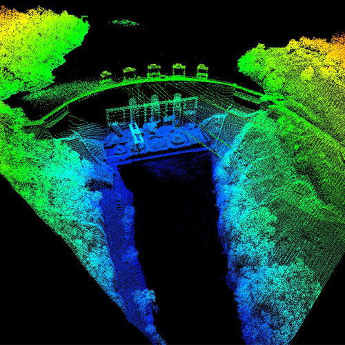
The section below displays a selection of LIDAR sample imagery from various Kinetics Geo LIDAR projects. To see additional Kinetics Geo sample data, or for more information about how we can help make your next LiDAR project a success, contact us today via email, or call us at 303.710.9200.
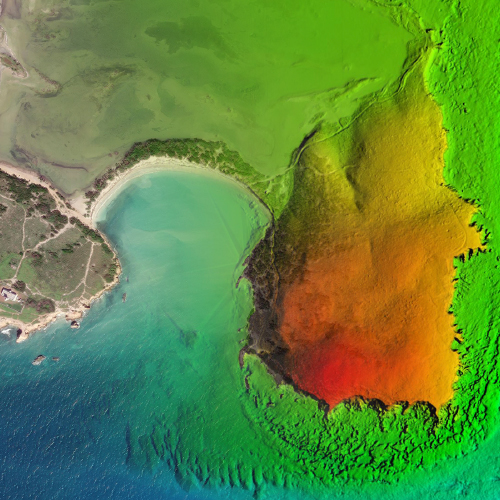
PUERTO RICO TOPOBATHYMETRIC LIDAR—2019
300 SQUARE MILES
Kinetics Geospatial was selected to partner with Dewberry Engineers to perform topo-bathymetric LiDAR classification for a coastal area of Puerto Rico.
All work was done to the NOAA / NGS classification scheme and specification.
STATE OF VIRGINIA LiDAR AND HYDROFLATTENING—2017-2018
14,213 SQUARE MILES OF LiDAR CLASSIFICATION (QL2 LiDAR)
13,907 SQUARE MILES OF HYDROFLATTENING (QL2 LiDAR)
Over a two-year span, Kinetics Geospatial classified LiDAR and performed hydro-flattening for a large area in the western region of the Commonwealth of Virginia.
All deliverables were in full compliance with the USGS LiDAR Base Specification v1.2.
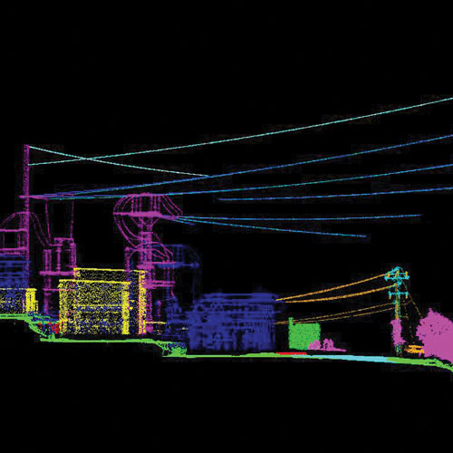
NORTH CAROLINA / VIRGINIA CORRIDOR MAPPING—2016-2018
2,376 MILES OF POWERLINE CORRIDOR
Kinetics Geospatial produced automated and manual LiDAR classification, planimetric collection, and catenary stringing. This project also included production / delivery of 1-inch orthoimagery of the project area of interest.
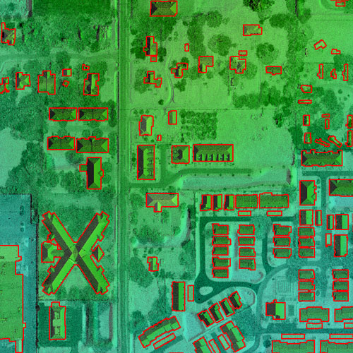
PASCO COUNTY, FLORIDA—BUILDING FOOTPRINT EXTRACTION—2018
620 SQUARE MILES QL1 LiDAR
Kinetics Geo performed automated feature extraction using LiDAR and intensity data to extract building footprints in Pasco County, FL. After the automated processing, each building footprint outline was checked for accuracy and edits were made where necessary.
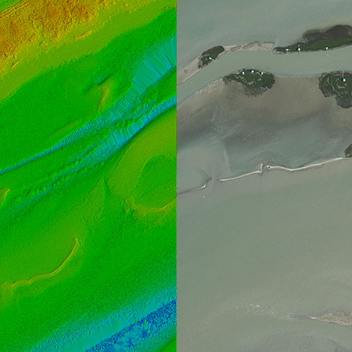
COASTAL TEXAS-TOPOBATHYMETRIC LiDAR—2019
867 SQUARE MILES QL1 LiDAR
Kinetics Geospatial performed LiDAR classification post-storm for the Hurricane Harvey Storm Topography / Bathymetry Project. This required correct topobathymetric LiDAR point cloud classification for 867 square miles of the Texas coastline. All topobathymetric work was performed in compliance with NOAA NGS standards.
Kinetics Geo offers an end-to-end LIDAR solution from data acquisition and production, to derived products deliverable in any format. LiDAR point cloud data can be leveraged to develop an array of geospatial products and services for different deliverables, and a variety of specialized LIDAR acquisition platforms can be deployed, depending on project specifications. These include topographic, bathymetric, mobile, and terrestrial sensor systems. Expert Kinetics Geo LiDAR professionals are well-versed in working with all forms of LIDAR used for mapping, modeling and managing your world.